Historical maps and estate plans indicate the location of a settlement at the confluence of the Cleuch Burn with Glengonnar Water five kilometers north of Leadhills. From biographies of Bevis Bulmer, John Hope’s first mine manager at Leadhills in the 1590s, it is possible that this settlement is the site of Bulmer’s house. No extant features mark the spot, but eight blocks of worked red sandstone have been found in the dykes of Victorian sheep folds on the site. It is likely that these sandstone blocks came from a substantial house or other building(s) on the site. With the cooperation of Leadhills Estate management it was decided to investigate the site through archaeological excavation. Work started in June 2024.
Aerial drone photography and geophysical resistivity assisted in the location of excavation trenches. A total of 22 trenches have been dug so far, the most interesting of which have been trenches 2/4 and 6.
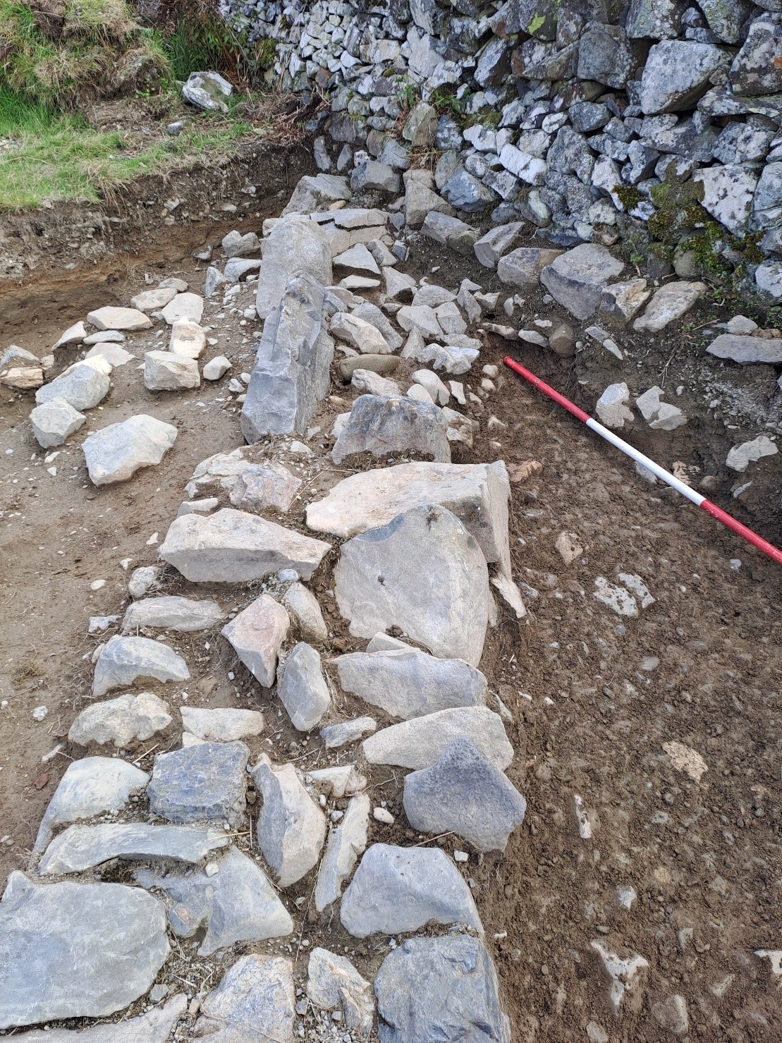
Linear stone features discovered in Ts 2/4 and 6 were substantial and had been set with purpose. On its southern side, the stone in T2/4 was hard against dark organic soil which descended to gravelly natural material. However, its northern side had stratified orange material – fine gravel, sands and silt which descended to a depth of 400mm before rising gently along a sloping cobbled surface. Similarly, in T6 a linear stone feature abutted organic material to the east with a subsequent paved surface on the western side and a pit containing stratified gravels, sands and silt on the eastern side to a depth of 1.4m. A steeper cobbled revetment marked the eastern edge of the excavation.
It is proposed that these were settling ponds, associated with gold prospecting, known as buddles. The hills to the east of the excavation site are crossed by channels on their lower slopes which are similar to those cut for hushing at other Leadhills locations – the use of waterpower to scour the hillside of gold. Hushed gravel would have flowed towards the buddle site where heavier sediments including gold would have sunk to the bottom of the ponds to have any gold picked out. A bank of fine material tails off to the north of the site which may have been the depository of tailings from the buddles.
A lens of burnt rock and coral limestone at the western end of T2 may have been dumped at the edge of the settling pond.
Much research needs to be done to confirm this theory. Buddles are recorded in Derbyshire and Cornwall but so far we have found no references in Scotland.
The excavation has been disappointing for the lack of finds – some glass, pottery and clay pipe stems from the upper horizons but these are likely to be Victorian in origin. This can be explained through the lack of habitation on the site. This seems to be an industrial site so we are yet to find a house. More geophysical work has been completed in the southern part of the enclosure and we will resume operations there in 2025 with the hope of finding Bulmer’s house this year. This disappointment should not detract from what may be the discovery of the first Scottish record of buddles.
The assistance of Mr Billy Steele with site location and the transportation of excavation tools is gratefully acknowledged.
Jim Ness
Biggar Archaeology Group
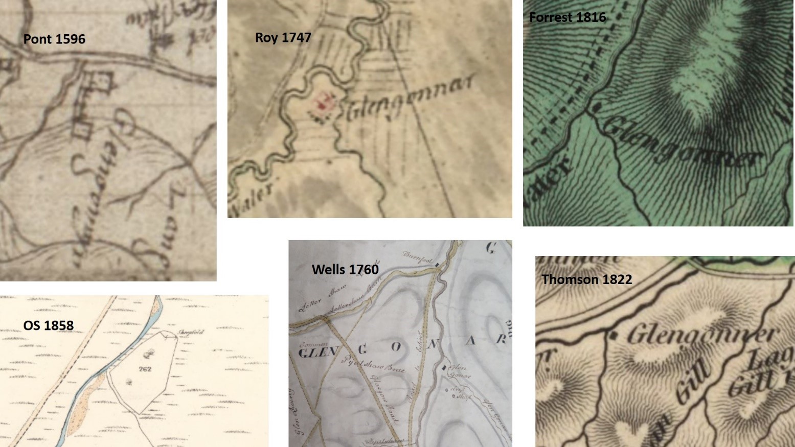
The site of Glengonnar settlement on historic maps
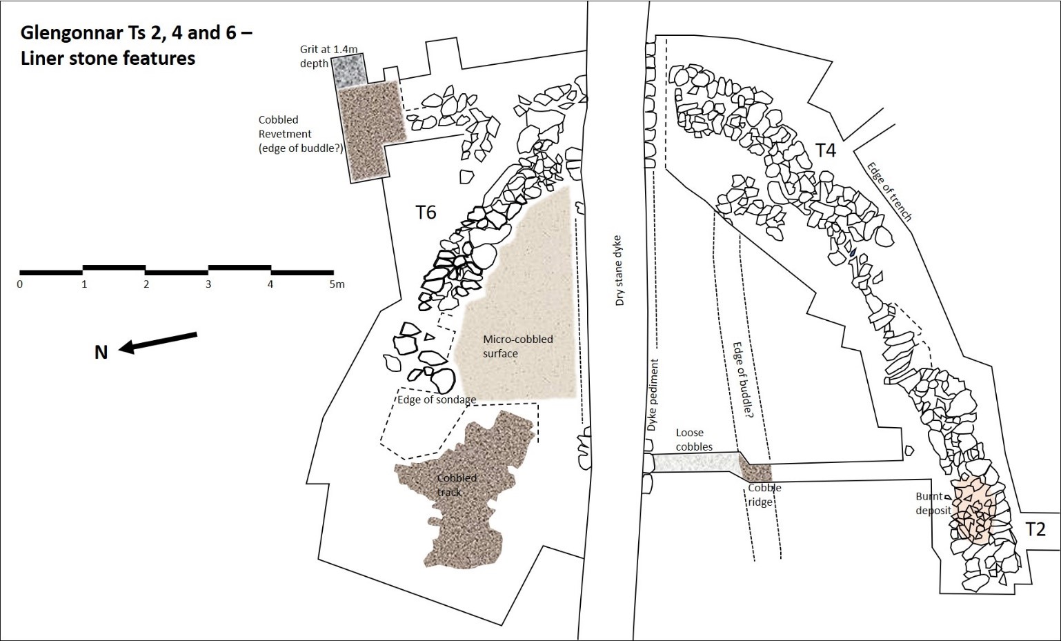
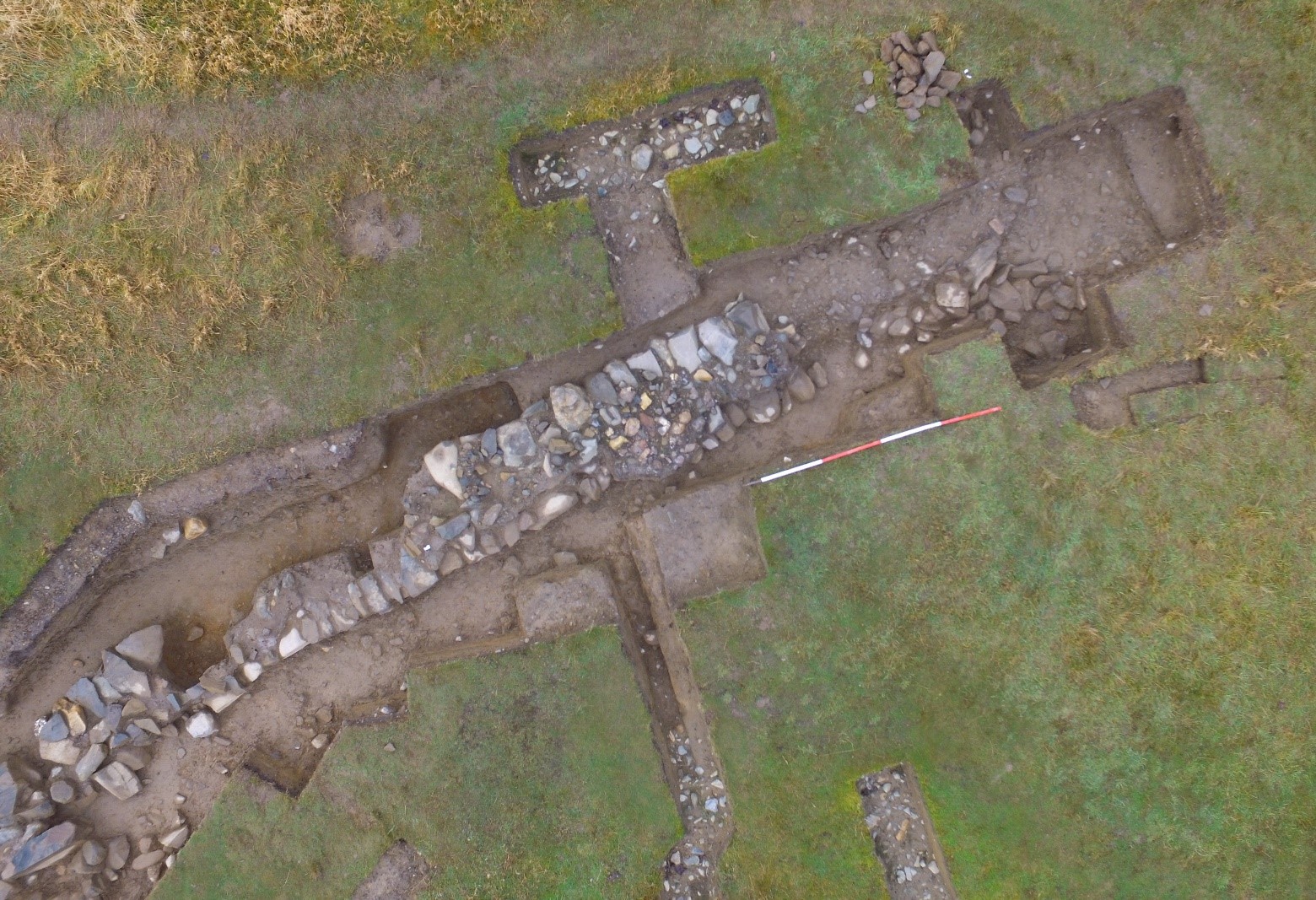
Linear stone feature discovered in trenches 2 and 4
Linear stone feature found in trench 6
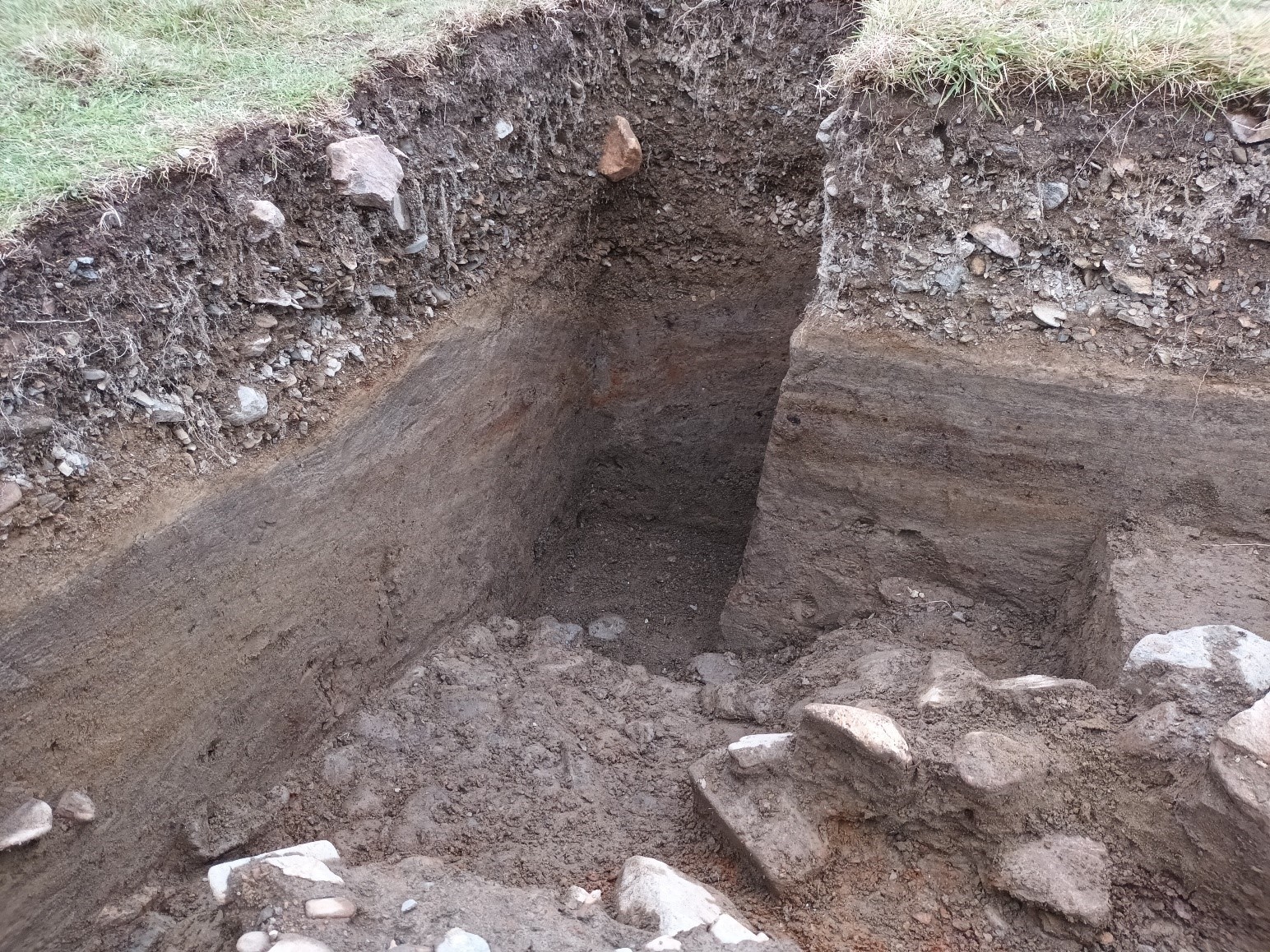
Stratified gravels, sands and silt in trench 6